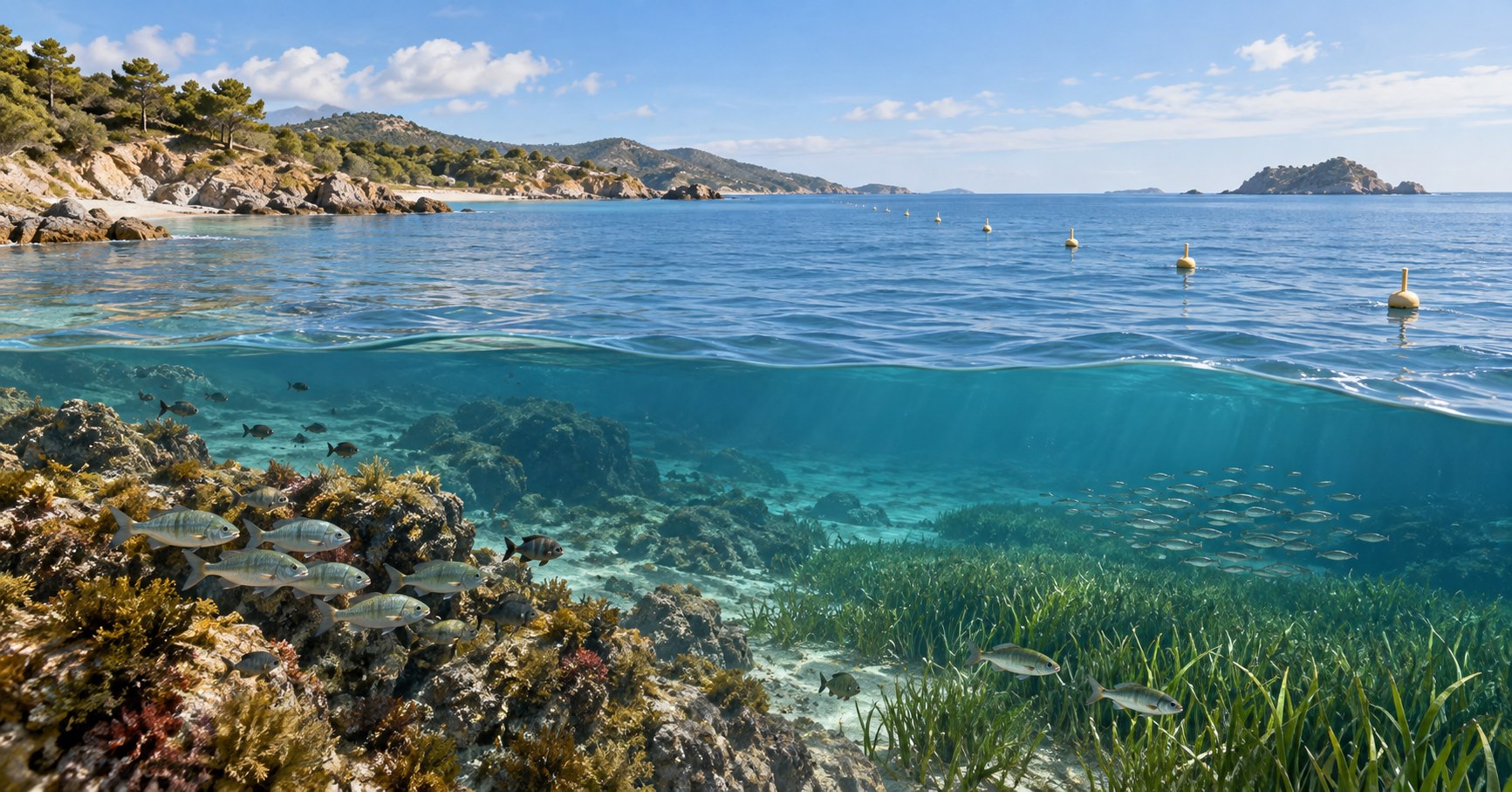
A marine protected area (MPA) works by matching a defined place and conservation goal with rules that reduce specific pressures, then backing those rules with compliance, enforcement, monitoring, and adjustment. The label alone does not protect an ecosystem. An MPA can be a strict no-take reserve, a multiple-use area, or a zoned combination of both. Whether it succeeds depends on what it protects, what is actually restricted, how well the rules are implemented, and whether the results are measured over a suitable time and scale.
This guide explains the mechanism rather than judging any one site. Rules vary by jurisdiction and can change, so anyone deciding whether fishing, anchoring, diving, transit, or another activity is legal must consult the current map, management plan, and notices from the responsible authority.
What is a marine protected area?
An MPA is a defined ocean or coastal area managed for long-term conservation. Depending on the place, its purpose may include protecting species, habitats, ecosystem services, fisheries resources, or cultural heritage. NOAA Ocean Exploration emphasizes that protection levels and permitted uses vary, while NOAA’s National Marine Protected Areas Center describes different legal authorities and management purposes in the United States.
That variation matters. “Marine protected area” is an umbrella term, not a promise that all extraction or access is prohibited. Comparing every MPA to a national park can be useful as a first approximation, but it can also hide major differences in zoning, legal authority, and day-to-day management.
The six links between designation and results
A boundary on a map can become ecological protection only if a chain of decisions and actions remains connected:
- Set a specific goal. Identify the habitat, species, ecological process, fishery resource, or cultural value that the area is meant to protect.
- Draw boundaries or zones that fit the goal. The design should cover the relevant habitat, movement pattern, life stage, or ecological connection.
- Adopt rules that address the main pressure. A rule is useful only if it reduces the activity causing the problem, such as extraction, seabed disturbance, or damaging anchoring.
- Make compliance possible and enforce the rules. Users need understandable maps and requirements; managers need authority, staff, resources, and a response to violations.
- Monitor implementation and outcomes. Tracking patrols or permits shows activity, but ecological and social indicators are needed to determine whether the goal is being achieved.
- Adjust management when evidence changes. Boundaries, rules, monitoring, or complementary measures may need revision if the pressure remains or the expected response does not appear.
This six-link chain is an editorial synthesis of official guidance, not a universal legal procedure. For example, England’s Marine Management Organisation guidance connects protected features and conservation objectives with management of fishing and other activities. NOAA likewise identifies science, implementation, and monitoring as necessary parts of effective management.
No-take reserves and multiple-use MPAs
A no-take reserve prohibits the removal of living or non-living resources within its boundary. A multiple-use MPA may allow some fishing, recreation, research, tourism, transit, or other activities, sometimes in separate zones or under permits. Neither term tells you every rule at a particular site.
Fisheries and Oceans Canada, for example, explains that activities may be compatible with an MPA when they do not compromise the protected ecological features or site objectives. That is a jurisdiction-specific example, not a global permission rule.
| Activity | Possible management approaches | What to check locally |
|---|---|---|
| Fishing or collecting | Fully prohibited, limited by gear/species/season, permitted in selected zones, or managed under another fishery rule | Zoning map, species and gear rules, seasons, permits, and emergency notices |
| Anchoring or seabed work | Prohibited in sensitive habitat, limited to moorings, or reviewed through permits | Habitat zones, navigation notices, mooring rules, and project authorizations |
| Diving, wildlife viewing, or tourism | Generally allowed, capped, guided, seasonally restricted, or excluded from sensitive areas | Access limits, operator requirements, wildlife distances, and temporary closures |
| Scientific research | Allowed with notification or a permit; sampling may face tighter controls | Research permits, collection rules, data conditions, and protected-species requirements |
| Shipping or transit | May remain open, follow routing or speed measures, or be controlled under separate maritime authority | Official nautical information and the responsible maritime authority |
The safe rule for readers is simple: never infer legality from the letters “MPA.” Use the site’s current official documents.
How reduced pressure can produce ecological change
If an MPA meaningfully reduces fishing mortality or habitat damage, organisms inside it may have more opportunities to survive, grow, and reproduce. Protecting nursery, spawning, feeding, or shelter habitat can also support important life stages. Over time, eggs, larvae, or mobile animals may move beyond the boundary. This is often called spillover.
Spillover is a possible pathway, not a guaranteed benefit. Its scale and timing depend on species movement, reproduction, currents, habitat connections, the age and position of the protected area, and pressure outside it. The NOAA MPA FAQ and Fisheries and Oceans Canada both describe these mechanisms, but neither mechanism replaces site-specific monitoring.
How location, size, and networks are chosen
There is no single correct size for every MPA. Design should work backward from the goal:
- A small area may protect a fixed habitat, a localized spawning event, or a cultural feature.
- A larger area may be needed for wide-ranging species, multiple habitats, or a process operating over a broader scale.
- A network can represent several habitat types and preserve connections among feeding, nursery, spawning, and migration areas.
Managers also have to consider where the main pressures occur, how organisms and water move, how people use the area, who has authority, and whether the design can be enforced. Woods Hole Oceanographic Institution describes how scientific information can help identify important life-history habitats, while NOAA distinguishes the roles of small sites, large areas, and networks. Bigger is not automatically better if the area misses the feature at risk or applies rules unrelated to the main pressure.
Do marine protected areas work?
They can, but results are uneven. The most useful question is not simply whether an area has been designated. Ask whether it has been designed, implemented, and monitored well enough to reduce the relevant pressure.
A widely cited 2014 comparison of 87 MPAs found stronger fish-community outcomes where several features occurred together: no-take rules, effective enforcement, more than ten years of protection, an area larger than 100 square kilometers, and isolation by deep water or sand. In that study, 59% of sampled MPAs had only one or two of the five features and were not ecologically distinguishable from fished sites in the analysis. The Nature study by Edgar and colleagues was observational, focused on fish-community measures, and used study-specific thresholds. Its five features should not be treated as a universal legal standard or a guarantee for every ecosystem.
More recent evidence adds important context. A 2024 matched analysis used more than 14,000 fish surveys around 216 MPAs in 43 countries and territories. It found positive fish-biomass outcomes relative to unprotected sites for both no-take and multiple-use MPAs, while showing that human pressure, staffing, and use rules changed their relative performance. The open-access PNAS study supports a portfolio view: protection level matters, but it cannot be separated from management capacity and local conditions. Its outcome was fish biomass, not every ecological, cultural, or equity goal.
Together, these studies support three distinct levels of evidence:
- Designated: the area has a legal or administrative status.
- Implemented: relevant rules, staffing, compliance, and enforcement operate in practice.
- Effective: monitoring detects results that match the stated goal, with reasonable attention to time, comparison, and alternative explanations.
Counting designated area answers the first question. It does not answer the other two.
How to measure effectiveness without overclaiming
Indicators should follow the goal. Patrol hours, budgets, and permits can show inputs. Violation rates and reductions in damaging activity can show implementation and pressure. Species abundance, body size, biomass, reproductive measures, habitat condition, access, or cultural outcomes may show results—but only when they match the objective.
| Goal | Main pressure | Management measure | Implementation evidence | Outcome evidence |
|---|---|---|---|---|
| Protect a spawning aggregation | Fishing at a predictable place or time | Spatial or seasonal fishing restriction | Fishing effort, compliance, violations, and enforcement response | Adult abundance and size structure, spawning observations, and recruitment measures over a suitable period |
| Protect seabed habitat | Activities that disturb the bottom | Gear, anchoring, access, or project restrictions | Activity footprint, permits, surveillance, and incidents | Habitat condition and recovery measures compared with a baseline or suitable reference |
| Protect cultural heritage | Physical damage or incompatible access | Access, anchoring, or handling rules developed under the relevant authority | Compliance and documented site management | Condition of the protected feature and outcomes defined with affected rights-holders |
This matrix is a reading tool, not a universal monitoring protocol. A strong evaluation also asks about the starting condition, what happened outside the boundary, how long recovery might take, and whether other policies changed at the same time.
That distinction is especially important for connected populations. An open-access Conservation Biology study of the Channel Islands MPA network explains why a clear difference inside versus outside protected areas does not automatically reveal the effect on the entire connected population. Spillover, displaced fishing effort, environmental variation, and the choice of comparison sites can all affect inference. A short-term or noisy result is not automatically proof of failure, and a positive local pattern is not automatically proof that the MPA caused every observed change.
Why governance and participation matter
MPA rules change who can use a place, when, and for what purpose. That creates ecological opportunities as well as costs and tradeoffs. Clear objectives, understandable requirements, stakeholder and rights-holder participation, credible responsibility, adequate staffing, and attention to livelihoods and cultural uses can influence legitimacy, compliance, and durability.
Participation does not replace protective rules, and strict rules do not replace governance. The relevant questions include: Who helped define the goal? Who bears the costs and receives the benefits? Who monitors the site? How are violations handled? Are data and limitations public? When and how will management be reviewed?
What an MPA cannot solve by itself
An MPA is a spatial management tool. It is best suited to pressures that can be reduced through place-based rules. A boundary cannot by itself stop ocean warming, acidification, pollutants arriving from outside, or fishing pressure shifted elsewhere. Migratory species may spend much of their lives beyond the protected area.
Effective marine conservation may therefore require pollution controls, climate action, fishery management, habitat restoration, shipping measures, species protection, and cooperation across jurisdictions. NOAA explicitly describes MPAs as one tool to use alongside other management measures, not a cure for every ocean problem.
A seven-question checklist for evaluating an MPA
When you encounter a claim that an MPA is effective, look for answers to these seven questions:
- What is being protected, and what is the stated goal?
- Where are the boundary and any internal zones?
- Which activities are prohibited, restricted, or allowed?
- Do those rules address the main pressure on the protected feature?
- Who is responsible for compliance and enforcement, and are resources reported?
- Which implementation and outcome indicators are monitored, against what baseline and time frame?
- Are results, limitations, and management reviews publicly available?
This checklist synthesizes principles from the official and research sources cited here. It is not an official certification system, a legal test, or a substitute for a site-level ecological assessment.
Diagnosing an MPA that is not meeting its goal
Weak results can have different causes, and each calls for a different response:
- Paper protection: the rules are too weak, unclear, poorly followed, or not enforced. The response concerns implementation and management capacity.
- Design mismatch: the boundary, zoning, rule, or indicator does not match the protected feature, movement pattern, or main pressure. The response concerns redesign.
- External pressure: well-implemented local rules are being overwhelmed by warming, pollution, shifted effort, or another cross-boundary driver. The response requires complementary action beyond the MPA.
Before assigning a cause, check whether the monitoring period is long enough and whether the evidence can separate MPA effects from environmental variation and other policies.
Frequently asked questions
Are all marine protected areas no-take?
No. Some prohibit resource extraction, while many allow selected activities or use different rules in different zones. Check the current local management documents.
Can you fish in a marine protected area?
Sometimes. Fishing may be prohibited, limited by zone, gear, species, or season, or governed through another authority. “MPA” alone is not enough information to determine what is legal.
Can an MPA help fisheries outside its boundary?
It can under some conditions through the movement of adults, eggs, or larvae, but spillover varies among species and places. It should be measured rather than promised.
How long does an MPA take to work?
There is no universal time. Detection depends on the starting condition, species life history, habitat, protection strength, compliance, environmental variability, and the indicator being measured.
The practical takeaway
Marine protected areas work when a clear objective is connected to a suitable place, rules that reduce the relevant pressure, real implementation, and monitoring that tests the intended result. They fail for different reasons: some exist mainly on paper, some are designed around the wrong pressure or scale, and some face forces that local boundaries cannot control.
For a specific MPA, begin with its official map, management plan, current regulations, and monitoring reports. Use the seven questions above to separate a conservation label from an operating protection system. For more background on habitat stewardship, restoration, and conservation tradeoffs, browse Wonout’s Conservation guides.
How this article was prepared: This guide compares current official explanations from NOAA, Fisheries and Oceans Canada, the UK Marine Management Organisation, and Woods Hole Oceanographic Institution with peer-reviewed studies of MPA design and outcomes. The six-link chain, evidence matrix, seven-question checklist, and failure diagnosis are editorial synthesis tools, not field research or official scoring systems. AI tools assisted with organizing source notes and draft structure; Judy Cen reviewed the sources, scope, wording, and final publication. Sources were rechecked on September 18, 2026.
Sources
- NOAA Ocean Exploration: What is a marine protected area?
- NOAA National Marine Protected Areas Center: Frequently Asked Questions
- Fisheries and Oceans Canada: About Marine Protected Areas
- UK Marine Management Organisation: Marine Protected Areas
- Edgar et al. (2014): Global conservation outcomes depend on marine protected areas with five key features
- Gill et al. (2024): A diverse portfolio of marine protected areas can better advance global conservation and equity
- Ovando et al. (2021): Assessing the population-level conservation effects of marine protected areas